Drone Technology in Infrastructure: The Future of Surveying
Updated on: 16th May, 2025
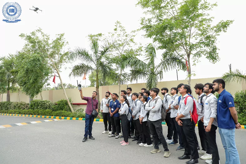
Drone surveying is emerging as a groundbreaking technology in the field of civil engineering, revolutionizing the way infrastructure projects are planned, executed, and monitored. By using unmanned aerial vehicles (UAVs) equipped with high-resolution cameras, LiDAR sensors, and GPS systems, civil engineers are now able to conduct accurate and efficient topographic surveys, monitor construction progress, assess structural conditions, and create detailed 3D models of sites.
This method significantly reduces the time, cost, and labour traditionally involved in surveying, while also enhancing safety by accessing hard-to-reach or hazardous areas without physical presence. From highways and bridges to dams and smart cities, drone surveying is becoming an essential tool across all phases of infrastructure development. Moreover, it presents substantial entrepreneurial opportunities, such as starting drone surveying consultancies, data analytics services, or offering training and certification programs for aspiring drone operators.
Recognizing its potential, the Department of Civil Engineering, Faculty of Engineering and Technology (FEAT), SGT University (SGTU) has been actively organizing hands-on training sessions and workshops for civil engineering students, equipping them with practical skills in drone operations, data processing, and industry-standard software. These initiatives aim to empower students with the knowledge and experience needed to lead in this rapidly evolving domain and seize emerging opportunities as skilled professionals or future entrepreneurs in the drone surveying industry.
Written By:
Dr. Neeraj Saini
HOD Civil Engineering